See Your Entire Property From a Better Point of View
CampScan Aerial creates current campground maps, documents access and visible property conditions, and produces organized aerial media your management team and guests can actually use.
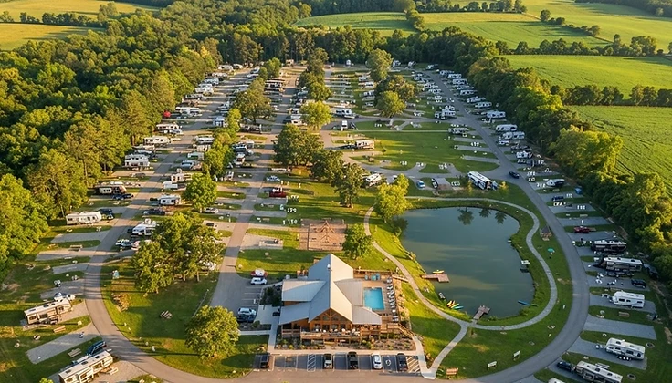
Most Property Problems Are Hard to See From the Ground
Owners may be working with outdated maps, unclear site numbering, difficult large-RV routes, undocumented drainage or road conditions, low branches, roof concerns, confusing guest circulation, and scattered property photographs. CampScan organizes current aerial imagery into practical maps, location-referenced observations, and visual records.
Current Property Maps
Labeled aerial maps that replace outdated or hand-drawn site plans with an accurate, current view of the entire property.
Access & Circulation Documentation
Organized imagery of entrances, intersections, turnarounds, and pinch points so large-RV routing and guest flow can be reviewed.
Visible Condition Records
Location-referenced observations of visible roads, roofs, drainage, vegetation, and overhead obstructions tied to numbered map points.
Marketing Photos & Video
Clean aerial photographs and edited video that show off the property for websites, social media, and guest communications.
Protect Your Property. Strengthen Your Claim. Simplify Your Renewal.
Aerial documentation that gives campground and RV park owners the visual record insurers actually ask for.
When did you last update your risk documentation for your insurance renewal?
Most campgrounds and RV parks have no dated visual record of their property — no way to prove what conditions looked like before a storm, before an incident, or before this year's renewal. When a claim happens, or an insurer asks for updated site documentation, owners are often left scrambling.
CampScan Aerial solves this with a single visit: a complete aerial record of your property, dated and ready to use for insurance, liability, and compliance purposes.
Annual (or semi-annual) aerial scans
A dated, comparable record of your property — this year vs. last year — showing erosion, storm damage, overgrowth near fire lanes, unauthorized structures, or any other change in condition over time.
Insurer-ready property and site maps
Clean, accurate maps showing access routes, hydrant and fire-suppression locations, evacuation routes, and site boundaries — built for adjusters and brokers to actually use.
Post-storm rapid documentation
If your property is hit by wind, flooding, or other severe weather, having "before" imagery already on file makes your claim dramatically easier to substantiate. Ask about expedited post-event scans.
Why It Matters
- Reduces liability exposure by creating a documented record of property conditions over time
- Speeds up and strengthens insurance claims after storm or incident damage
- Meets the growing trend of insurers requesting updated aerial or risk documentation at renewal
- Builds a year-over-year record that becomes more valuable with each scan
Get your property documented before your next renewal.
Request a Risk Documentation ScanCampScan Aerial — Mapping, Safety & Inspections From Above

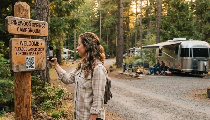
A QR Code Your Campers Actually Use
Every CampScan guest map comes with a scannable QR code campers access the moment they arrive — no app to download, no paper to lose. One scan opens a clean, mobile-friendly guide to your property that saves your front desk a dozen repeat questions.
- Interactive property map they can pinch-to-zoom on their phone
- Amenities, rules, and check-in details right at their fingertips
- Tap-to-call front desk and emergency info in one place
- Fewer front-desk questions and a smoother arrival experience
- Updated each season with your annual plan — the QR never changes
Five Clear Ways to Document Your Property
Transparent starting prices. Every level is scope-reviewed and quoted in writing before booking.
CampScan Operations
Mapping plus access, circulation, and organized visible-condition observations.
from $1,795
CampScan Complete
Operations documentation, refined guest map, observation report, promotional photographs, and edited aerial video.
from $3,250
CampScan Enterprise
Custom plans for large, complex, multi-property, seasonal, or specialized assignments.
from $5,500
CampScan Risk Documentation
A dated aerial record built for insurance, liability, and compliance — waterways, buildings, trees, flood areas, roads, bridges, and every feature that can affect a claim.
from $1,495
A Clear, Six-Step Workflow
Property consultation
Airspace and project review
Written scope and fixed quote
Scheduled aerial and ground capture
Mapping, documentation, and quality control
Client review and final delivery
What You Receive
Organized, labeled, and ready to use — not a folder of random clips.

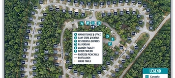 Demonstration Example
Labeled Aerial Property Map

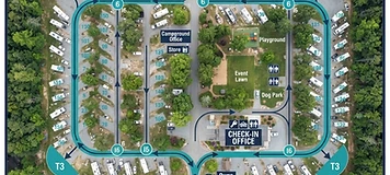 Demonstration Example
Operations & Circulation Map

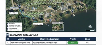 Demonstration Example
Visual Observation Report

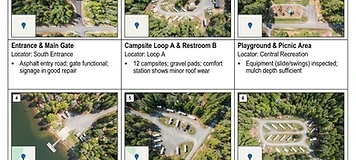 Demonstration Example
Numbered Photo Appendix

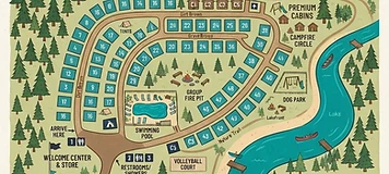 Demonstration Example
Guest Map

 Demonstration Example
Aerial Promotional Photography

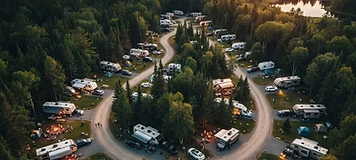 Demonstration Example
Promotional Video

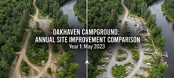 Demonstration Example
Annual Before-and-After Comparison


More Than Pretty Footage — A Usable Property Package
Most drone services sell attractive footage. CampScan combines systematic capture, map creation, management verification, organized visual observations, and optional marketing media into one usable property package built for campground operators.
- Systematic capture organized for management use, not just social media
- Maps, reports, and media delivered in labeled, organized folders
- Location-referenced observations tied to numbered map points
- Optional annual comparison programs to track changes over time